
The map is a topographical representation of many features such as positioning, places, and sectors, whereas the plan is a three-dimensional representation of a region, territory, structure, or building that involves a variety of detailed information.
Here are some of the main differences between map and plan to help you understand how both differ:
Map Vs Plan:
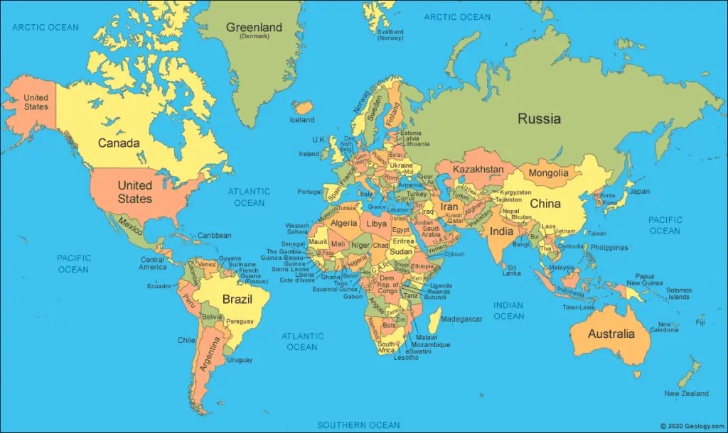
Map:
All of the information displayed on maps is visible on-site.
The map depicts an examination of the entire area. It is provided information on critical locations.
The map offers a wealth of information, it is just highlighting the most essential aspects of the area.
A map is a top-down picture of a territory larger than a few structures.
The total size of the construction may or may not be shown on a map.
It will indicate the structure’s border as well as the surrounding infrastructure such as roads, bridges, sewers, electricity towers/lines, DP points, and so on.
A map is involved with the position of certain items and covers a large region.
Maps are recorded in municipal offices, but plans are filed as part of the property record at the courts.
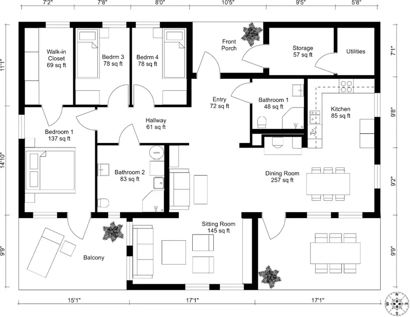
Plan:
A plan is a specialized map.
It also incorporates illustrations and secret data.
A plan is often for a single structure or a group of structures with a maximum of three or four structures.
It defines the precise proportions of all necessary information, the position of structural pieces, and any additional legends that the user needs.
It delivers comprehensive information in the form of symbols about small areas.
Details are provided in the form of symbols in the plan; hence it may display both length and width.
A survey plan is placed on the map indicating the improvements proposed for the area and the intended borders of subdivided portions.
What is Difference between Map and Plan?
A map is a visual representation of a geographic region and itmay also be described as a symbolic representation demonstrating links between space components such as objects, regions, and themes whereas a plan is a collection of two-dimensional diagrams or drawings that are used to describe a location or an item or to transmit building or manufacturing instructions.
Let’s discuss the difference between a map and a plan:
| Map | Plan |
| The plan is termed a map if the size of the graphical depiction on a horizontal plane is modest. | A plan is a graphical representation of characteristics on, behind, or beneath the earth’s surface placed on a horizontal plane. |
| A map on a tiny scale is generated. | A large-scale plan is created. |
| Scale: 1 cm Equals 100 m or more. | Scale: 1 centimetre Equals 10 m or 10 m. |
| Contour lines on a topographic map also represent vertical distances (altitudes). | Unlike Map, Horizontal lengths and directions are frequently shown on a plan. |
| A wide-area map is created. | A plan for a tiny region is created. |
| For example, Area Map. | For example, a home plan or a bridge layout. |
Also read: Contour Interval | Reconnaissance Survey | Levelling | Chain Surveying | Plane Table Surveying
Conclusion:
After reading this article you learned a lot about the differences between a map and a plan.
A map and a plan are used to examine the location of a proposed project and to evaluate the positive or negative influence on the project.
Similarly, a map will be a valuable source for geographically determining a plan’s border co-ordinates and other features.
Related Posts
Rock Quality Designation(RQD): Building Strong Foundations
Spread Footing
Masonry Cement
Plain Cement Concrete
Concrete Efflorescence
Concrete Pile
Stepped Footing
Fineness Modulus of Coarse Aggregates
Difference between Condo and Apartment